
Stalowa Wola topographic map
Interactive map
Click on the map to display elevation.
About this map
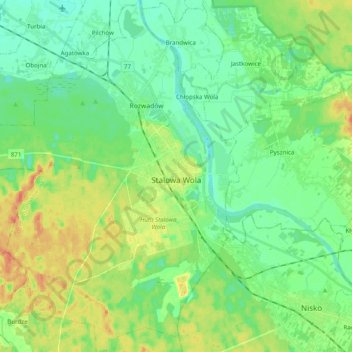
Name: Stalowa Wola topographic map, elevation, terrain.
Average elevation: 159 m
Minimum elevation: 143 m
Maximum elevation: 188 m
Other topographic maps
Click on a map to view its topography, its elevation and its terrain.
Stalowa Wola
Poland > Subcarpathian Voivodeship > Stalowa Wola County > Stalowa Wola
Stalowa Wola, Stalowa Wola County, Subcarpathian Voivodeship, 37-450, Poland
Average elevation: 158 m