
Thank you for supporting this site ❤️
Make a donation
Make a donation
Bharatpur topographic map
Click on the map to display elevation.
Thank you for supporting this site ❤️
Make a donation
Make a donation
About this map
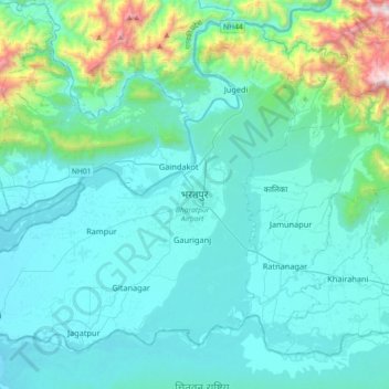
Name: Bharatpur topographic map, elevation, terrain.
Location: Bharatpur, Chitwan, Bagamati Province, 44207, Nepal (27.52119 84.27017 27.84119 84.59017)
Average elevation: 363 m
Minimum elevation: 147 m
Maximum elevation: 1,854 m
Thank you for supporting this site ❤️
Make a donation
Make a donation
Other topographic maps
Click on a map to view its topography, its elevation and its terrain.