
Santa Fe topographic map
Interactive map
Click on the map to display elevation.
About this map
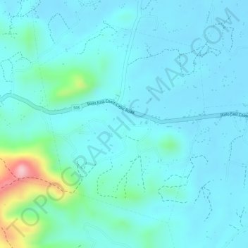
Name: Santa Fe topographic map, elevation, terrain.
Location: Santa Fe, Pilar, Capiz, Bisayas Occidentales, Filipinas (11.47339 123.03859 11.49497 123.05697)
Average elevation: 38 m
Minimum elevation: 6 m
Maximum elevation: 206 m
Other topographic maps
Click on a map to view its topography, its elevation and its terrain.