
Guilin topographic map
Interactive map
Click on the map to display elevation.
About this map
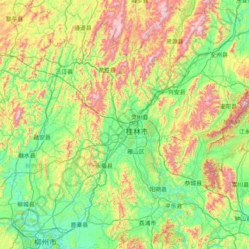
Name: Guilin topographic map, elevation, terrain.
Location: Guilin, Guangxi, Chine (24.26275 109.61164 26.38787 111.48759)
Average elevation: 477 m
Minimum elevation: 65 m
Maximum elevation: 2,046 m
Other topographic maps
Click on a map to view its topography, its elevation and its terrain.