
Thank you for supporting this site ❤️
Make a donation
Make a donation
Borne topographic map
Click on the map to display elevation.
Thank you for supporting this site ❤️
Make a donation
Make a donation
About this map
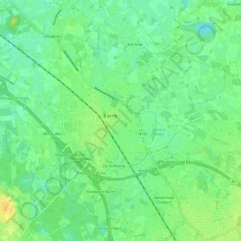
Name: Borne topographic map, elevation, terrain.
Location: Borne, Overijssel, Nederland (52.28311 6.68948 52.31782 6.79816)
Average elevation: 16 m
Minimum elevation: 6 m
Maximum elevation: 31 m
Thank you for supporting this site ❤️
Make a donation
Make a donation