
Champoluc topographic map
Interactive map
Click on the map to display elevation.
About this map
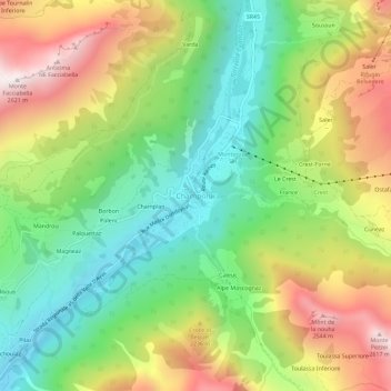
Name: Champoluc topographic map, elevation, terrain.
Location: Champoluc, Valle d'Aosta, 11020, Italia (45.81164 7.70600 45.85164 7.74600)
Average elevation: 1,968 m
Minimum elevation: 1,514 m
Maximum elevation: 2,610 m