
Helena topographic map
Interactive map
Click on the map to display elevation.
About this map
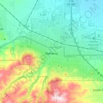
Name: Helena topographic map, elevation, terrain.
Location: Helena, Lewis and Clark County, Montana, États-Unis (46.55922 -112.08328 46.62948 -111.94811)
Average elevation: 1,298 m
Minimum elevation: 1,128 m
Maximum elevation: 1,741 m