
Nord (Holland) topographic map
Interactive map
Click on the map to display elevation.
About this map
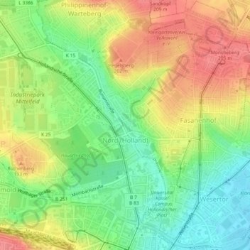
Name: Nord (Holland) topographic map, elevation, terrain.
Location: Nord (Holland), Kassel, Hessen, 34109, Duitsland (51.31805 9.47323 51.34634 9.50836)
Average elevation: 172 m
Minimum elevation: 137 m
Maximum elevation: 208 m
Other topographic maps
Click on a map to view its topography, its elevation and its terrain.
Silberborn
Silberborn, Harleshausen, Kassel, Hessen, 36292, Duitsland
Average elevation: 400 m