
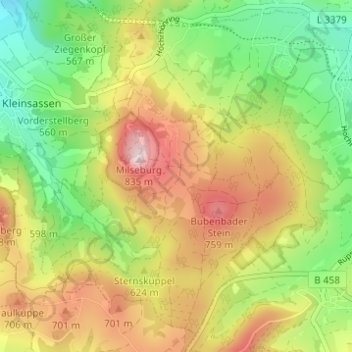
Danzwiesen topographic map
Interactive map
Click on the map to display elevation.
About this map
Name: Danzwiesen topographic map, elevation, terrain.
Location: Danzwiesen, Hofbieber, Landkreis Fulda, Hessen, Deutschland (50.52513 9.85773 50.56027 9.91921)
Average elevation: 610 m
Minimum elevation: 434 m
Maximum elevation: 807 m
Other topographic maps
Click on a map to view its topography, its elevation and its terrain.
Obergruben
Deutschland > Hessen > Hofbieber > Obergruben
Obergruben, Hofbieber, Ehrenberg (Rhön), Landkreis Fulda, Hessen, Deutschland
Average elevation: 526 m
Obernüst
Deutschland > Hessen > Hofbieber
Obernüst, Hofbieber, Landkreis Fulda, Hessen, Deutschland
Average elevation: 491 m