
Holtum topographic map
Interactive map
Click on the map to display elevation.
About this map
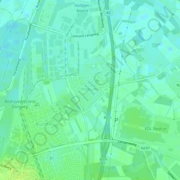
Name: Holtum topographic map, elevation, terrain.
Location: Holtum, Sittard-Geleen, Limburg, Nederland (51.03959 5.81591 51.05486 5.82683)
Average elevation: 33 m
Minimum elevation: 28 m
Maximum elevation: 41 m
Other topographic maps
Click on a map to view its topography, its elevation and its terrain.
Obbicht
Nederland > Limburg > Sittard-Geleen
Obbicht, Sittard-Geleen, Limburg, Nederland
Average elevation: 36 m
Buchten
Nederland > Limburg > Sittard-Geleen > Buchten
Buchten, Sittard-Geleen, Limburg, Nederland
Average elevation: 34 m