
Thank you for supporting this site ❤️
Make a donation
Make a donation
Lac Jens topographic map
Click on the map to display elevation.
Thank you for supporting this site ❤️
Make a donation
Make a donation
About this map
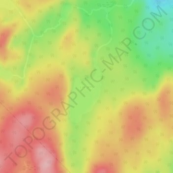
Name: Lac Jens topographic map, elevation, terrain.
Location: Lac Jens, Lac-Matawin, Matawinie, Lanaudière, Québec, Canada (46.72998 -74.17396 46.74124 -74.16647)
Average elevation: 542 m
Minimum elevation: 453 m
Maximum elevation: 611 m
Thank you for supporting this site ❤️
Make a donation
Make a donation
Other topographic maps
Click on a map to view its topography, its elevation and its terrain.