
달서구 topographic map
Interactive map
Click on the map to display elevation.
About this map
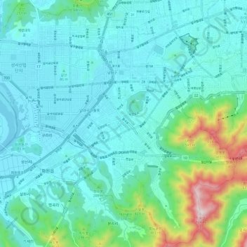
Name: 달서구 topographic map, elevation, terrain.
Location: 달서구, Daegu, Corée du Sud (35.77238 128.46854 35.86940 128.58814)
Average elevation: 136 m
Minimum elevation: 7 m
Maximum elevation: 757 m