
Hornisgrinde topographic map
Interactive map
Click on the map to display elevation.
About this map
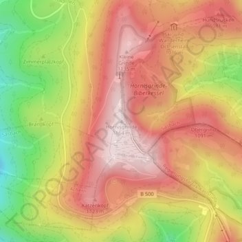
Name: Hornisgrinde topographic map, elevation, terrain.
Average elevation: 968 m
Minimum elevation: 675 m
Maximum elevation: 1,163 m
De Hornisgrinde is een berg in de deelstaat Baden-Württemberg, Duitsland. De berg heeft een hoogte van 1.163 meter en is gelegen in het Zwarte Woud.