
Mont Sōng topographic map
Interactive map
Click on the map to display elevation.
About this map
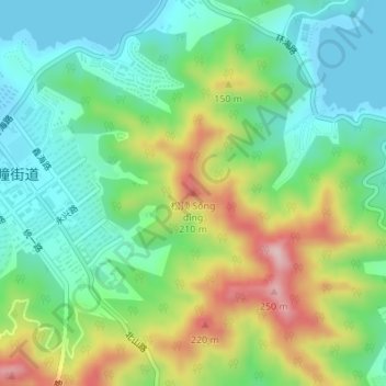
Name: Mont Sōng topographic map, elevation, terrain.
Location: Mont Sōng, Weihai, 环翠区 (Huancui), 威海市, Shandong, 264200, RPC (37.53829 122.12496 37.53839 122.12506)
Average elevation: 97 m
Minimum elevation: -1 m
Maximum elevation: 282 m