
Assent topographic map
Interactive map
Click on the map to display elevation.
About this map
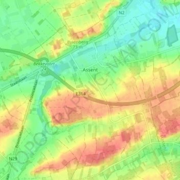
Name: Assent topographic map, elevation, terrain.
Location: Assent, Bekkevoort, Leuven, Vlaams-Brabant, België (50.92483 4.98589 50.96932 5.04531)
Average elevation: 50 m
Minimum elevation: 20 m
Maximum elevation: 85 m