
دار بن عبد الله topographic map
Interactive map
Click on the map to display elevation.
About this map
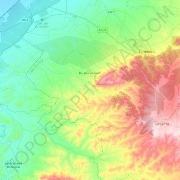
Name: دار بن عبد الله topographic map, elevation, terrain.
Location: دار بن عبد الله, دائرة زمورة, Provincia de Relizan, Argelia (35.63854 0.60675 35.72271 0.83517)
Average elevation: 263 m
Minimum elevation: 52 m
Maximum elevation: 637 m