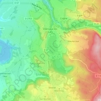
Clairvaux-les-Lacs topographic map
Interactive map
Click on the map to display elevation.
About this map
Name: Clairvaux-les-Lacs topographic map, elevation, terrain.
Average elevation: 562 m
Minimum elevation: 430 m
Maximum elevation: 787 m

Click on the map to display elevation.
Name: Clairvaux-les-Lacs topographic map, elevation, terrain.
Average elevation: 562 m
Minimum elevation: 430 m
Maximum elevation: 787 m