
Thank you for supporting this site ❤️
Make a donation
Make a donation
Kampung Ulu Perting topographic map
Click on the map to display elevation.
Thank you for supporting this site ❤️
Make a donation
Make a donation
About this map
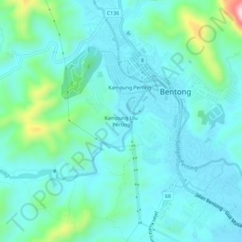
Name: Kampung Ulu Perting topographic map, elevation, terrain.
Location: Kampung Ulu Perting, Bentong, Pahang, 29700, Malaysia (3.49474 101.88436 3.53474 101.92436)
Average elevation: 143 m
Minimum elevation: 81 m
Maximum elevation: 443 m
Thank you for supporting this site ❤️
Make a donation
Make a donation