
Oostvoorne topographic map
Interactive map
Click on the map to display elevation.
About this map
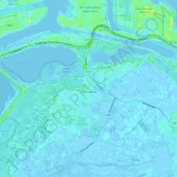
Name: Oostvoorne topographic map, elevation, terrain.
Location: Oostvoorne, Westvoorne, Südholland, Niederlande (51.89500 4.03777 51.93614 4.15338)
Average elevation: 2 m
Minimum elevation: -6 m
Maximum elevation: 18 m
Other topographic maps
Click on a map to view its topography, its elevation and its terrain.
Rockanje
Niederlande > Südholland > Westvoorne
Rockanje, Westvoorne, Südholland, Niederlande
Average elevation: 1 m