
Thank you for supporting this site ❤️
Make a donation
Make a donation
Guacarí topographic map
Click on the map to display elevation.
Thank you for supporting this site ❤️
Make a donation
Make a donation
About this map
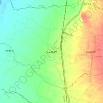
Name: Guacarí topographic map, elevation, terrain.
Location: Guacarí, Centro, Valle del Cauca, Colombia (3.72302 -76.37449 3.80302 -76.29449)
Average elevation: 970 m
Minimum elevation: 936 m
Maximum elevation: 1,024 m
Thank you for supporting this site ❤️
Make a donation
Make a donation