
Białystok topographic map
Interactive map
Click on the map to display elevation.
About this map
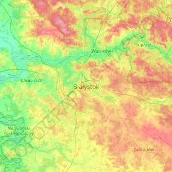
Name: Białystok topographic map, elevation, terrain.
Location: Białystok, Podlaskie Voivodeship, 15-426, Poland (52.97240 22.99917 53.29240 23.31917)
Average elevation: 142 m
Minimum elevation: 101 m
Maximum elevation: 199 m