
Région Famenne et Calestienne topographic map
Interactive map
Click on the map to display elevation.
About this map
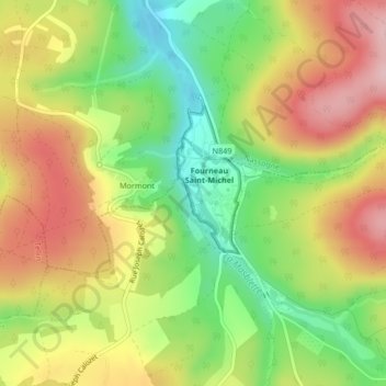
Name: Région Famenne et Calestienne topographic map, elevation, terrain.
Average elevation: 359 m
Minimum elevation: 259 m
Maximum elevation: 461 m
Other topographic maps
Click on a map to view its topography, its elevation and its terrain.
Région Lorraine belge
Belgique > Luxembourg > Neufchâteau > Awenne
Région Lorraine belge, Awenne, Saint-Hubert, Neufchâteau, Luxembourg, Wallonie, 6870, Belgique
Average elevation: 363 m