
Thank you for supporting this site ❤️
Make a donation
Make a donation
Big Level topographic map
Click on the map to display elevation.
Thank you for supporting this site ❤️
Make a donation
Make a donation
About this map
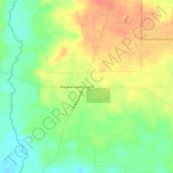
Name: Big Level topographic map, elevation, terrain.
Location: Big Level, Stone County, Mississippi, United States (30.79158 -89.07143 30.83158 -89.03143)
Average elevation: 53 m
Minimum elevation: 28 m
Maximum elevation: 78 m
Thank you for supporting this site ❤️
Make a donation
Make a donation
Other topographic maps
Click on a map to view its topography, its elevation and its terrain.