
Saint Rhemy topographic map
Interactive map
Click on the map to display elevation.
About this map
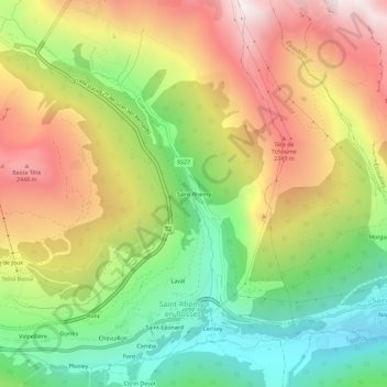
Name: Saint Rhemy topographic map, elevation, terrain.
Location: Saint Rhemy, Saint-Rhémy-en-Bosses, Valle d'Aosta, 11014, Italia (45.81560 7.16386 45.85560 7.20386)
Average elevation: 1,907 m
Minimum elevation: 1,299 m
Maximum elevation: 2,611 m