
Thank you for supporting this site ❤️
Make a donation
Make a donation
Fairfax topographic map
Click on the map to display elevation.
Thank you for supporting this site ❤️
Make a donation
Make a donation
About this map
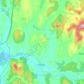
Name: Fairfax topographic map, elevation, terrain.
Location: Fairfax, Franklin County, Vermont, 05454, United States (44.63321 -73.08483 44.77299 -72.92264)
Average elevation: 208 m
Minimum elevation: 85 m
Maximum elevation: 589 m
Thank you for supporting this site ❤️
Make a donation
Make a donation
Other topographic maps
Click on a map to view its topography, its elevation and its terrain.
Thank you for supporting this site ❤️
Make a donation
Make a donation
Enosburg Center
United States > Vermont > Franklin County > Enosburg > Enosburg Center
Average elevation: 231 m
Thank you for supporting this site ❤️
Make a donation
Make a donation