
Thank you for supporting this site ❤️
Make a donation
Make a donation
La Joux topographic map
Click on the map to display elevation.
Thank you for supporting this site ❤️
Make a donation
Make a donation
About this map
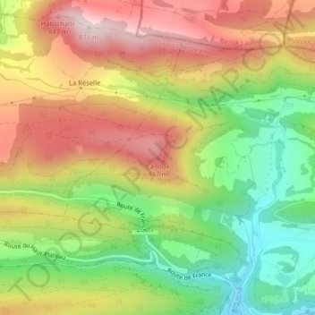
Name: La Joux topographic map, elevation, terrain.
Location: La Joux, Soyhières, District de Delémont, Jura, 2805, Suisse (47.40452 7.35993 47.40462 7.36003)
Average elevation: 631 m
Minimum elevation: 401 m
Maximum elevation: 867 m
Thank you for supporting this site ❤️
Make a donation
Make a donation