
Thank you for supporting this site ❤️
Make a donation
Make a donation
Thaakath topographic map
Click on the map to display elevation.
Thank you for supporting this site ❤️
Make a donation
Make a donation
About this map
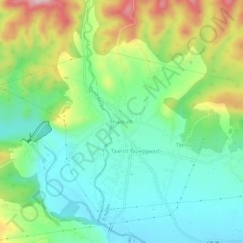
Name: Thaakath topographic map, elevation, terrain.
Location: Thaakath, El Adjiba, Bechloul District, Bouira, 10087, Algeria (36.34049 4.09924 36.38049 4.13924)
Average elevation: 467 m
Minimum elevation: 380 m
Maximum elevation: 643 m
Thank you for supporting this site ❤️
Make a donation
Make a donation