
Thank you for supporting this site ❤️
Make a donation
Make a donation
Radwinter topographic map
Click on the map to display elevation.
Thank you for supporting this site ❤️
Make a donation
Make a donation
About this map
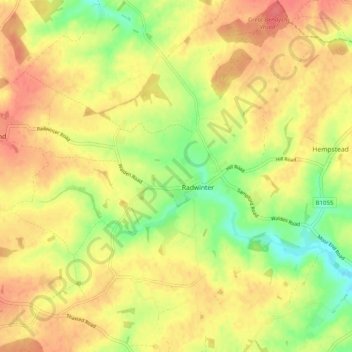
Name: Radwinter topographic map, elevation, terrain.
Location: Radwinter, Uttlesford, Essex, England, United Kingdom (51.98253 0.30807 52.04361 0.37830)
Average elevation: 103 m
Minimum elevation: 70 m
Maximum elevation: 126 m
Thank you for supporting this site ❤️
Make a donation
Make a donation
Other topographic maps
Click on a map to view its topography, its elevation and its terrain.