
Thank you for supporting this site ❤️
Make a donation
Make a donation
Deckbergen topographic map
Click on the map to display elevation.
Thank you for supporting this site ❤️
Make a donation
Make a donation
Deckbergen
Der Ort erstreckt sich auf einer Höhe von etwa 60–150 m über Normalnull und hat 822 Einwohner (Stand: 31. Dezember 2022).
Thank you for supporting this site ❤️
Make a donation
Make a donation
About this map
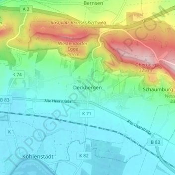
Name: Deckbergen topographic map, elevation, terrain.
Average elevation: 125 m
Minimum elevation: 54 m
Maximum elevation: 314 m
Thank you for supporting this site ❤️
Make a donation
Make a donation
Other topographic maps
Click on a map to view its topography, its elevation and its terrain.