
Thank you for supporting this site ❤️
Make a donation
Make a donation
Holdenville topographic map
Click on the map to display elevation.
Thank you for supporting this site ❤️
Make a donation
Make a donation
About this map
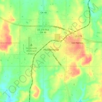
Name: Holdenville topographic map, elevation, terrain.
Location: Holdenville, Hughes County, Oklahoma, 74848, United States (35.06364 -96.44611 35.09956 -96.36892)
Average elevation: 263 m
Minimum elevation: 235 m
Maximum elevation: 298 m
Thank you for supporting this site ❤️
Make a donation
Make a donation