
Deuxième lac Beauvais topographic map
Interactive map
Click on the map to display elevation.
About this map
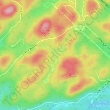
Name: Deuxième lac Beauvais topographic map, elevation, terrain.
Average elevation: 432 m
Minimum elevation: 344 m
Maximum elevation: 520 m
Other topographic maps
Click on a map to view its topography, its elevation and its terrain.
Mont Bel Air
Mont Bel Air, Val-Morin, Les Laurentides, Laurentides, Québec, J8B 2N7, Canada
Average elevation: 358 m