
Thank you for supporting this site ❤️
Make a donation
Make a donation
Padan topographic map
Click on the map to display elevation.
Thank you for supporting this site ❤️
Make a donation
Make a donation
About this map
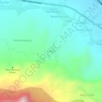
Name: Padan topographic map, elevation, terrain.
Location: Padan, Lampung Selatan, Lampung, Sumatra, 35592, Indonesia (-5.76565 105.62956 -5.72565 105.66956)
Average elevation: 251 m
Minimum elevation: 63 m
Maximum elevation: 783 m
Thank you for supporting this site ❤️
Make a donation
Make a donation
Other topographic maps
Click on a map to view its topography, its elevation and its terrain.