
Croft topographic map
Interactive map
Click on the map to display elevation.
About this map
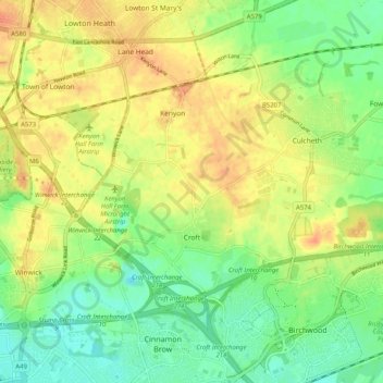
Name: Croft topographic map, elevation, terrain.
Location: Croft, Warrington, England, Vereinigtes Königreich (53.42602 -2.58460 53.46150 -2.48265)
Average elevation: 27 m
Minimum elevation: 7 m
Maximum elevation: 47 m