
Thank you for supporting this site ❤️
Make a donation
Make a donation
Lindloh topographic map
Click on the map to display elevation.
Thank you for supporting this site ❤️
Make a donation
Make a donation
About this map
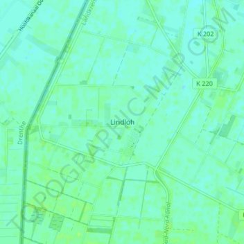
Name: Lindloh topographic map, elevation, terrain.
Average elevation: 15 m
Minimum elevation: 11 m
Maximum elevation: 19 m
Thank you for supporting this site ❤️
Make a donation
Make a donation
Other topographic maps
Click on a map to view its topography, its elevation and its terrain.
Schloss Dankern
Deutschland > Niedersachsen > Landkreis Emsland > Haren (Ems) > Altharen > Dankern
Average elevation: 12 m
Dankernsee
Deutschland > Niedersachsen > Landkreis Emsland > Haren (Ems) > Dankern
Average elevation: 13 m