
Thank you for supporting this site ❤️
Make a donation
Make a donation
Sylamore topographic map
Click on the map to display elevation.
Thank you for supporting this site ❤️
Make a donation
Make a donation
About this map
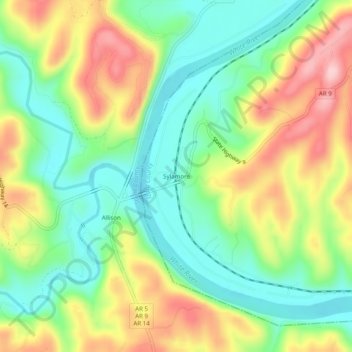
Name: Sylamore topographic map, elevation, terrain.
Location: Sylamore, Izard County, Arkansas, 72050, United States (35.92146 -92.12821 35.96146 -92.08821)
Average elevation: 162 m
Minimum elevation: 80 m
Maximum elevation: 282 m
Thank you for supporting this site ❤️
Make a donation
Make a donation
Other topographic maps
Click on a map to view its topography, its elevation and its terrain.