
Thank you for supporting this site ❤️
Make a donation
Make a donation
Chicken Breast Bluff topographic map
Click on the map to display elevation.
Thank you for supporting this site ❤️
Make a donation
Make a donation
About this map
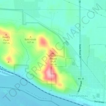
Name: Chicken Breast Bluff topographic map, elevation, terrain.
Average elevation: 232 m
Minimum elevation: 194 m
Maximum elevation: 355 m
Thank you for supporting this site ❤️
Make a donation
Make a donation
Other topographic maps
Click on a map to view its topography, its elevation and its terrain.
Perrot State Park
United States > Wisconsin > Trempealeau County > Town of Trempealeau
Average elevation: 223 m
Thank you for supporting this site ❤️
Make a donation
Make a donation