Geolocate

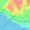
Bicesse topographic map

Click on the map to display elevation.

About this map

Name: Bicesse topographic map, elevation, terrain.

Location: Bicesse, Alcabideche, Cascais, Lisbon, 2654-117, Portugal (38.70925 -9.40410 38.74925 -9.36410)

Average elevation: 99 m

Minimum elevation: 33 m

Maximum elevation: 200 m

Other topographic maps

Click on a map to view its topography, its elevation and its terrain.

São Domingos de Rana

Portugal > Lisbon > Cascais

Average elevation: 91 m

Estoril

Portugal > Lisbon > Cascais

Average elevation: 49 m

Parede

Portugal > Lisbon > Cascais

Average elevation: 37 m

Alcabideche

Portugal > Lisbon > Cascais

Average elevation: 143 m

Carcavelos

Portugal > Lisbon > Cascais

Average elevation: 36 m

Alcabideche

Portugal > Lisbon > Cascais

Average elevation: 143 m

Atrozela

Portugal > Lisbon > Cascais

Average elevation: 121 m

Estoril

Portugal > Lisbon > Cascais

Average elevation: 49 m