
Thank you for supporting this site ❤️
Make a donation
Make a donation
Cerezal topographic map
Click on the map to display elevation.
Thank you for supporting this site ❤️
Make a donation
Make a donation
About this map
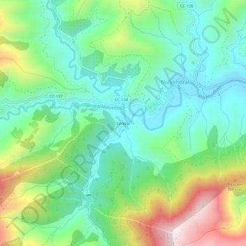
Name: Cerezal topographic map, elevation, terrain.
Location: Cerezal, Nuñomoral, Cáceres, Extremadura, 10626, España (40.38220 -6.27567 40.42220 -6.23567)
Average elevation: 675 m
Minimum elevation: 460 m
Maximum elevation: 1,143 m
Thank you for supporting this site ❤️
Make a donation
Make a donation