
Thank you for supporting this site ❤️
Make a donation
Make a donation
Kalangbret topographic map
Click on the map to display elevation.
Thank you for supporting this site ❤️
Make a donation
Make a donation
About this map
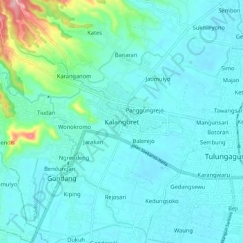
Name: Kalangbret topographic map, elevation, terrain.
Location: Kalangbret, Tulungagung, East Java, Jawa, 66261, Indonesia (-8.09482 111.82571 -8.01482 111.90571)
Average elevation: 104 m
Minimum elevation: 79 m
Maximum elevation: 251 m
Thank you for supporting this site ❤️
Make a donation
Make a donation