
梅溪湖街道 topographic map
Interactive map
Click on the map to display elevation.
About this map
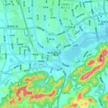
Name: 梅溪湖街道 topographic map, elevation, terrain.
Location: 梅溪湖街道, Yuelu, Changsha, Hunan, China (28.15975 112.83876 28.21511 112.91838)
Average elevation: 69 m
Minimum elevation: 29 m
Maximum elevation: 231 m