
Thank you for supporting this site ❤️
Make a donation
Make a donation
Ennetbürgen topographic map
Click on the map to display elevation.
Thank you for supporting this site ❤️
Make a donation
Make a donation
About this map
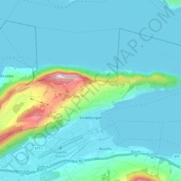
Name: Ennetbürgen topographic map, elevation, terrain.
Location: Ennetbürgen, Nidwald, 6373, Suisse (46.97244 8.37410 47.01721 8.46906)
Average elevation: 521 m
Minimum elevation: 426 m
Maximum elevation: 1,096 m
Thank you for supporting this site ❤️
Make a donation
Make a donation
Other topographic maps
Click on a map to view its topography, its elevation and its terrain.