
Nyanga Province topographic map
Interactive map
Click on the map to display elevation.
About this map
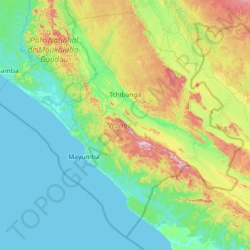
Name: Nyanga Province topographic map, elevation, terrain.
Location: Nyanga Province, Gabon (-4.10123 9.90740 -2.23836 11.97500)
Average elevation: 144 m
Minimum elevation: 0 m
Maximum elevation: 910 m
Other topographic maps
Click on a map to view its topography, its elevation and its terrain.