
Sólheimar topographic map
Interactive map
Click on the map to display elevation.
About this map
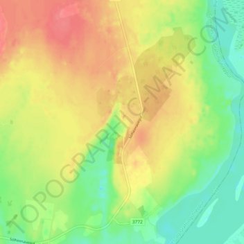
Name: Sólheimar topographic map, elevation, terrain.
Average elevation: 74 m
Minimum elevation: 43 m
Maximum elevation: 105 m
Other topographic maps
Click on a map to view its topography, its elevation and its terrain.
Kerid
Iceland > Grímsnes- og Grafningshreppur
Kerid, Grímsnes- og Grafningshreppur, Southern Region, Iceland
Average elevation: 71 m