
Thank you for supporting this site ❤️
Make a donation
Make a donation
Paguyangan topographic map
Click on the map to display elevation.
Thank you for supporting this site ❤️
Make a donation
Make a donation
About this map
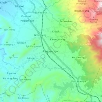
Name: Paguyangan topographic map, elevation, terrain.
Location: Paguyangan, Brebes, Central Java, Java, 52276, Indonesia (-7.34040 108.99754 -7.26040 109.07754)
Average elevation: 378 m
Minimum elevation: 130 m
Maximum elevation: 1,127 m
Thank you for supporting this site ❤️
Make a donation
Make a donation
Other topographic maps
Click on a map to view its topography, its elevation and its terrain.