
Whitianga topographic map
Interactive map
Click on the map to display elevation.
About this map
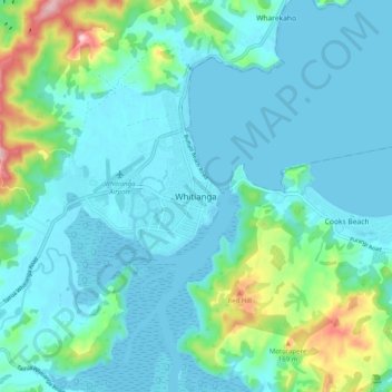
Name: Whitianga topographic map, elevation, terrain.
Average elevation: 43 m
Minimum elevation: 0 m
Maximum elevation: 253 m
Other topographic maps
Click on a map to view its topography, its elevation and its terrain.
Coromandel
Nouvelle-Zélande > Waikato > Thames-Coromandel District > Coromandel
Coromandel, Thames-Coromandel District, Waikato, 3543, Nouvelle-Zélande
Average elevation: 114 m