
Thank you for supporting this site ❤️
Make a donation
Make a donation
Bellevue topographic map
Click on the map to display elevation.
Thank you for supporting this site ❤️
Make a donation
Make a donation
About this map
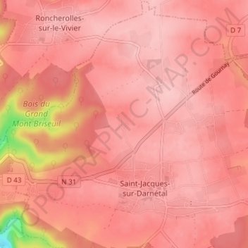
Name: Bellevue topographic map, elevation, terrain.
Average elevation: 148 m
Minimum elevation: 30 m
Maximum elevation: 172 m
Thank you for supporting this site ❤️
Make a donation
Make a donation
Other topographic maps
Click on a map to view its topography, its elevation and its terrain.
76160
France > Normandie > Seine-Maritime > Saint-Jacques-sur-Darnétal > Les Forgettes
Average elevation: 142 m