
Make a donation
Harran topographic map
Click on the map to display elevation.
Make a donation
Harran
The precise location of the ancient great Ekhulkhul temple is unknown and no certain archaeological evidence of it has yet been found. It is likely that one of the major medieval buildings of Harran displaced the Elkhulkhul and were constructed on top of it, either the Harran Castle or the Grand Mosque. Writings from the Islamic period contradictingly claim that the castle or the mosque were the converted moon temple. The castle being on the site of the ancient temple is further supported by its higher elevation whereas the mosque is further supported by the finds of Babylonian inscriptions and four stelae of Nabonidus among its ruins. These inscriptions and stelae directly mention the Elkhulkhul. Additionally, the remains of an ancient altar with moon iconography have also been recovered from the ruins of the mosque. As a result, the mosque enjoys more scholarly support as the most likely site of the ancient temple.
Make a donation
About this map
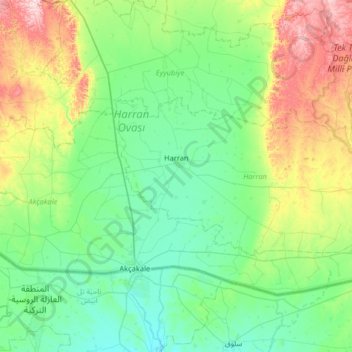
Name: Harran topographic map, elevation, terrain.
Location: Harran, Şanlıurfa, Southeastern Anatolia Region, Turkey (36.72714 38.91317 36.96045 39.56120)
Average elevation: 428 m
Minimum elevation: 329 m
Maximum elevation: 754 m
Make a donation
Other topographic maps
Click on a map to view its topography, its elevation and its terrain.
Mount Ararat
Mount Ararat (/ˈærəræt/, ARR-ə-rat; Armenian: Արարատ, romanized: Ararat), also known as Mount Ağrı (Turkish: Ağrı Dağı) or Masis (Armenian: Մասիս), is a snow-capped and dormant compound volcano in eastern Turkey. It consists of two major volcanic cones: Greater Ararat and Little Ararat.…
Average elevation: 4,582 m
Make a donation
Ankara
Ankara has a cold semi-arid climate (Köppen climate classification: BSk). Under the Trewartha climate classification, Ankara has a temperate humid continental climate (Dc). Due to its elevation and inland location, Ankara has cold and snowy winters, and hot and dry summers. Rainfall occurs mostly during the…
Average elevation: 1,082 m
Make a donation
Make a donation