
Calton Hill topographic map
Interactive map
Click on the map to display elevation.
About this map
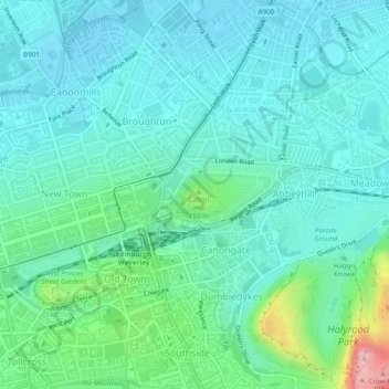
Name: Calton Hill topographic map, elevation, terrain.
Average elevation: 54 m
Minimum elevation: 10 m
Maximum elevation: 239 m
Other topographic maps
Click on a map to view its topography, its elevation and its terrain.
Arthur's Seat
Royaume-Uni > Écosse > Édimbourg
Arthur's Seat, Édimbourg, City of Edinburgh, Écosse, EH8 8HG, Royaume-Uni
Average elevation: 69 m