
Frazumeira topographic map
Interactive map
Click on the map to display elevation.
About this map
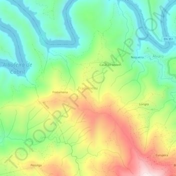
Name: Frazumeira topographic map, elevation, terrain.
Location: Frazumeira, Álvaro, Oleiros, Castelo Branco, Portugal (39.94818 -8.00619 39.98818 -7.96619)
Average elevation: 483 m
Minimum elevation: 261 m
Maximum elevation: 842 m
Other topographic maps
Click on a map to view its topography, its elevation and its terrain.