
Thank you for supporting this site ❤️
Make a donation
Make a donation
Gunung Belumut topographic map
Click on the map to display elevation.
Thank you for supporting this site ❤️
Make a donation
Make a donation
About this map
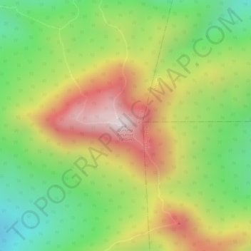
Name: Gunung Belumut topographic map, elevation, terrain.
Location: Gunung Belumut, Kluang, Johor, Malaysia (2.04250 103.56119 2.04260 103.56129)
Average elevation: 639 m
Minimum elevation: 328 m
Maximum elevation: 969 m
Thank you for supporting this site ❤️
Make a donation
Make a donation
Other topographic maps
Click on a map to view its topography, its elevation and its terrain.
Thank you for supporting this site ❤️
Make a donation
Make a donation